

OrthoGraphic Mapping and Surveying
OrthoGraphic Mapping and Surveying
Get all the GIS layers you need quickly and efficiently.
Get all the GIS layers you need quickly and efficiently.

Crafting GIS websites is far easier than you might think
even if you need to get GIS layers of an entire city.
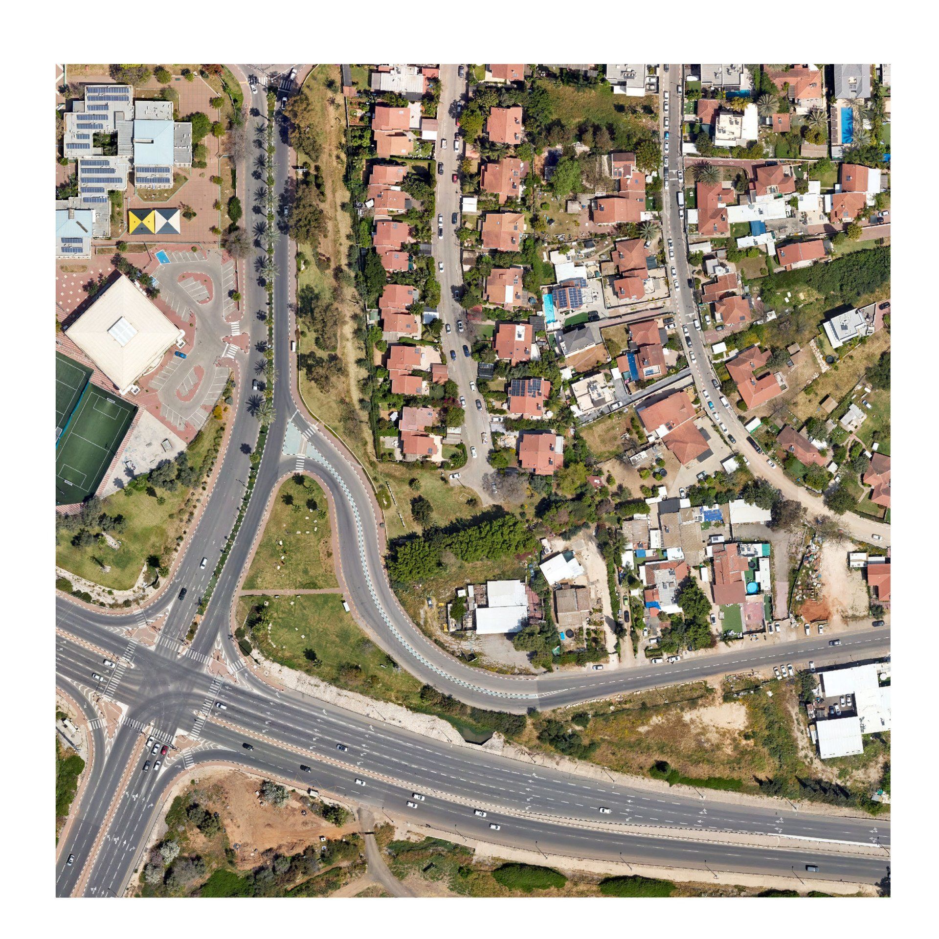
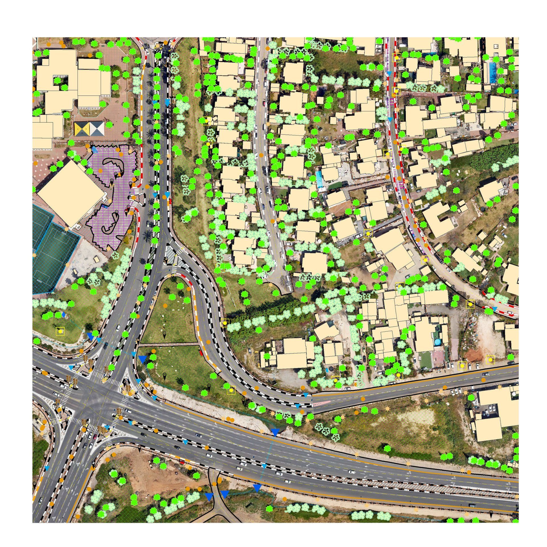
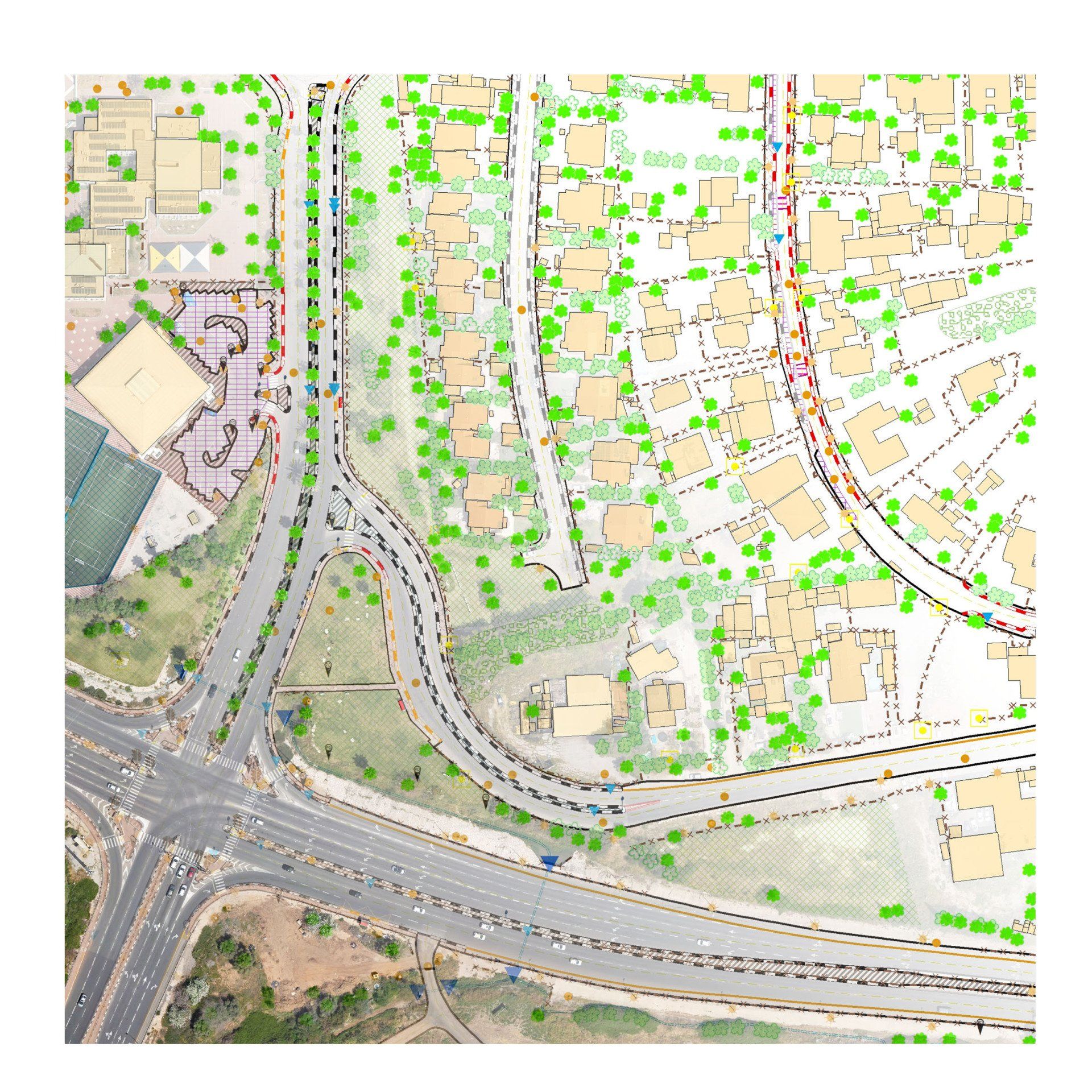
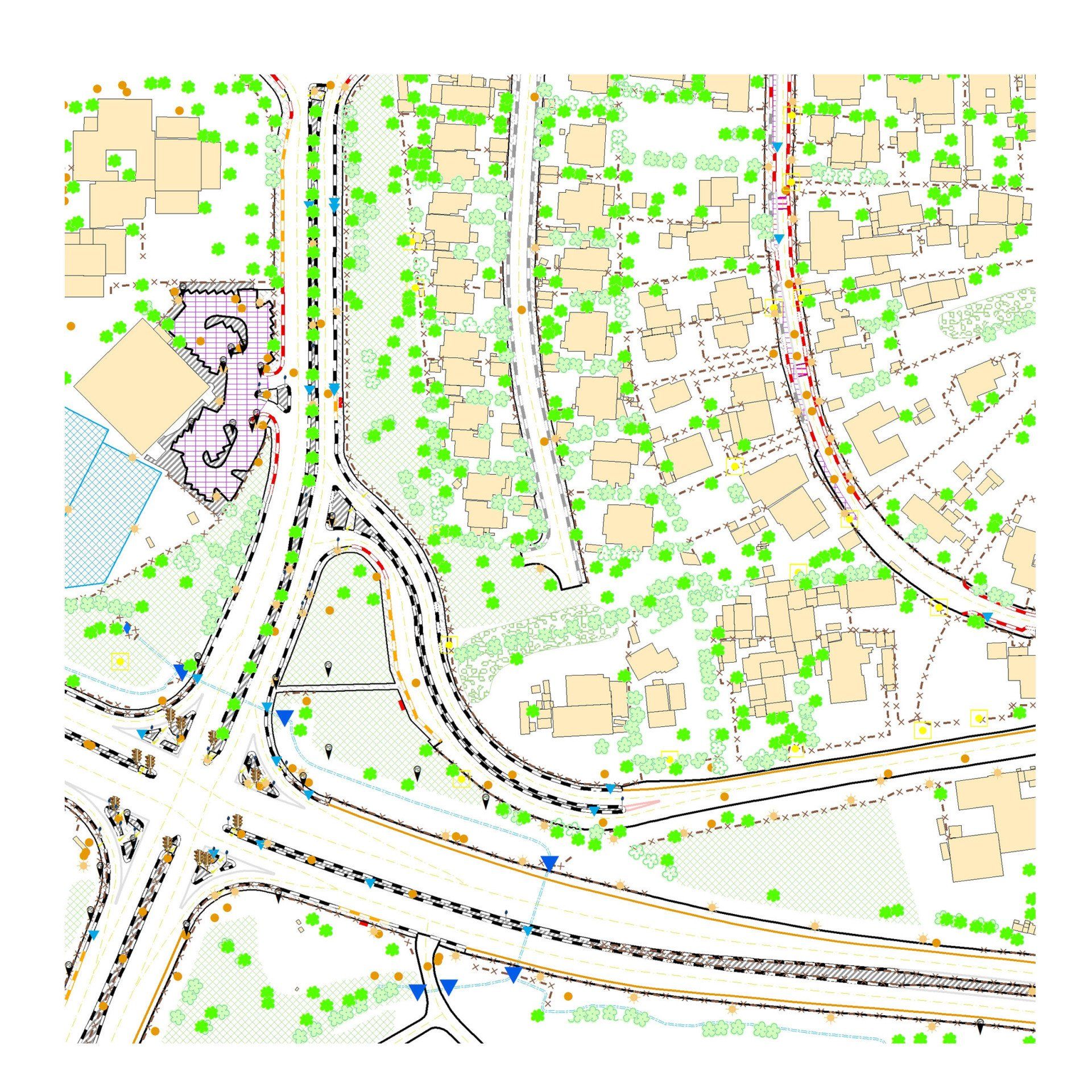
At Hammer GIS, we start with high-resolution aerial images,
then we collect all necessary elements and compile them into GIS layers,
giving you exactly what you need to develop a GIS website and more!
And at Hammer GIS, we make the process affordable.
Check out this orthographic survey example
You can use the example below to turn layers on and off to really get a feel for how an orthographic survey works and the kind of information it delivers.
ALL THE LAYERS
YOU NEED IN ONE SURVEY
Challenge
Challenge
Establishing a GIS website or system is a real challenge.
Accumulating geographical information layer by layer is extremely time consuming.
Making the survey this way is quite expensive, and the results are often far from satisfying.
That’s why Hammer GIS offers an affordable, full-package solution.
Using deep machine learning
and a small team of expert photo decoders, Hammer GIS can digitize all elements from a high-resolution aerial image into GIS layers.
You’ll get a high-quality product with remarkable speed and a remarkably affordable price.
There are so many valuable uses for an orthographic survey.
City engineering departments, architects and more need geographic information to properly plan and manage their projects.
Unfortunately, accumulated geographic information is often compiled over a very long time and from different sources, meaning its layers are rarely up to date and unknown accuracy.
With an orthographic survey by Hammer GIS, we can deliver the ideal GIS layers by using the information and elements from a high-resolution aerial photo. There is no other product like this in the market!
So get in touch with Hammer GIS, and we’ll help you fully explore the advantages of GIS.
